Groundwater Atlas To Promote Efficient Water Resource Management In Abu Dhabi
Mohammad Ali (@ChaudhryMAli88) Published January 16, 2019 | 03:15 PM
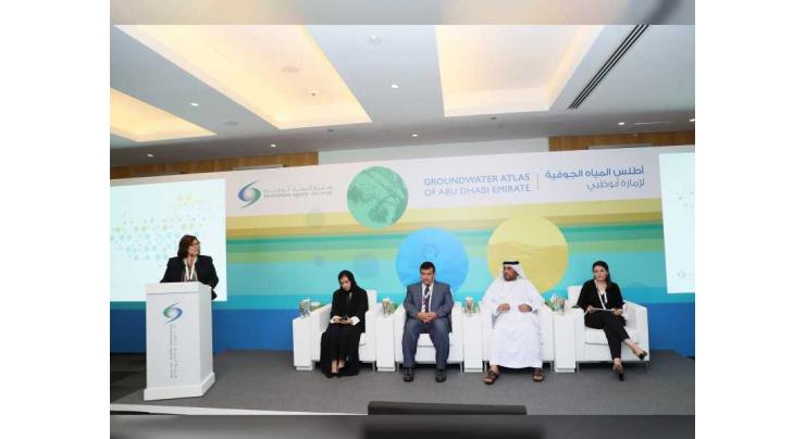
ABU DHABI, (UrduPoint / Pakistan Point News / WAM - 16th Jan, 2019) The Environment Agency - Abu Dhabi (EAD), the largest environmental regulator in the middle East, today launched the first-ever Abu Dhabi Groundwater Atlas at the World Future Energy Summit (WFES), being held in Abu Dhabi from 14-17 January.
The Atlas summarises the quantity, quality, natural, chemical and biological properties, location, depth and type of groundwater resources in the emirate in the form of annotated maps, charts, tables and graphs. This data will help track and analyse the status, levels and uses of groundwater reserves in the emirate. The findings will assist authorities in improving and promoting the efficient use of water resources in Abu Dhabi.
The Atlas took three years to compile and was carried out in three phases. It incorporates the results of the Groundwater Wells Inventory project that recorded over 100 measurement parameters, including the abstraction volume, water levels, salinity, coordinates, type, well depth and use of over 118,000 wells in the Emirate of Abu Dhabi. Each groundwater well in Abu Dhabi has been assigned a unified identification number to ensure it is easily traceable and identifiable. The maps also combine outcomes of the Soil Salinity Mapping initiative, in which soil samples from more than 4,000 farms were analysed to determine the soil type, salinity and quality in order to study the sustainability of crops and farming in Abu Dhabi.
"Groundwater has always been considered a precious resource in our nation, and an inherent and essential asset to our survival and progress," said Dr. Shaikha Salem Al Dhaheri, Acting Secretary General of the Environment Agency – Abu Dhabi. "The Abu Dhabi Groundwater Atlas underscores our efforts in compiling, interpreting and analysing all relevant groundwater sources in the emirate. It will serve as a valuable reference tool for policy makers, water managers, scientists and researchers who are working towards preserving our groundwater stores.
This initiative will also go a long way in supporting stakeholders in developing a sustainable, integrated and effective water resource management plan to ensure that we use this scarce resource responsibly and efficiently – in line with government directives."
"Among the key findings from the Abu Dhabi Groundwater Atlas is the strong link of differences in the groundwater levels in Abu Dhabi to areas of irrigation and agricultural activity in the emirate," noted Shaikha Al Hosani, Executive Director of EAD’s Environmental Quality Sector. "The analysis shows that areas with fast declining groundwater reserves coincide with the areas of highest groundwater abstraction for agricultural irrigation. In fact, the water level in groundwater monitoring wells has dropped by more than 20 metres in Remah, and by over 14 metres in the Liwa Crescent over the course of only 12 years.
"However, in some parts of Abu Dhabi, this trend has reversed over the last few years – in Madinat Zayed, groundwater levels have risen since 2010 following a decline for many years. Other regions, especially in the northeast, also show rising water levels in comparison to records from 2005, which can mainly be attributed to a reduction in agricultural activity," she added.
The Abu Dhabi Groundwater Atlas represents an essential component of EAD’s comprehensive and integrated groundwater management and regulation programme, which promotes innovative solutions to address the increasing challenges facing non-renewable groundwater resources in Abu Dhabi - in cooperation with both public and private sector stakeholders. Nearly two-thirds (65 per cent) of water used in Abu Dhabi is groundwater – almost 2,100,000 cubic metres per year flowing mainly from the Hajjar Mountains on the Omani border towards the Arabian Gulf. Nearly 80 per cent of groundwater reserves in the emirate are used primarily for farm agriculture, irrigation of forestry and afforestation.
Recent Stories

Tennis: ATP Barcelona Open results - 1st update
5 hours ago

Swiatek's perfect 10 in Stuttgart as Vondrousova stuns Sabalenka
5 hours ago

Arandu's roads closed due to flooding
5 hours ago

Oil tanker catches fire in Islamabad’s Blue Area
5 hours ago

Pakistan committed to ensure safety of foreign nationals: FO
5 hours ago

Tennis: WTA Stuttgart results - 1st update
5 hours ago

Four passengers injured as train hit an empty vehicle
5 hours ago

Over- speeding bus crushed to death two bike riders
5 hours ago

Turkey's Freedom Flotilla ready to set sail for Gaza
5 hours ago

French teen dies from heart failure after knife attack near school
5 hours ago

Iranians appear unfazed by Isfahan blasts
5 hours ago

UAF celebrates Int'l Chinese Language Day
5 hours ago
More Stories From Middle East
-

UAE announces ‘Zero Bureaucracy Program’ to reduce bureaucracy
3 months ago -
COP28 President-Designate welcomes Transitional Committee agreement to operationalise Loss and Damag ..
6 months ago -
Global Media Congress 2023 to feature Co-Production Majlis as a new networking platform
6 months ago -
Young female athletes shine at Abu Dhabi World Youth Jiu-Jitsu Championship
6 months ago -
King of Jordan receives Abdullah bin Zayed and ministers participating in Arab coordination meeting
6 months ago -
Abdullah bin Zayed participates in coordination meeting of Arab foreign ministers, joint meeting wit ..
6 months ago


-
3rd annual conference of Emirates Society of Clinical Microbiology kicks off in Dubai
6 months ago -
SIBF 2023 hosts Nobel laureate to discuss emergence of ‘Afrofuturism’ in global discourse
6 months ago -
ALC announces winners of Kanz Al Jeel Award 2023
6 months ago -
SIBF turns spotlight on remarkable contributions of women
6 months ago -
Global assets in spot bitcoin ETFs hit $4.16 billion
6 months ago -
Rescuers struggle to find Nepal quake survivors as deaths reach 157
6 months ago


