Remote Sensing Satellite Heralds Agricultural And Environmental Revolution, Say Experts
Mohammad Ali (@ChaudhryMAli88) Published August 03, 2025 | 06:40 PM
MULTAN, (UrduPoint / Pakistan Point News - 3rd Aug, 2025) The recent launch of Pakistan’s state-of-the-art remote sensing satellite is being hailed as a technological milestone with far-reaching implications for the country’s agriculture, environment, and disaster management.
Experts from South Punjab have termed it a “game changer” that could usher in a new era of sustainable growth and data-driven development across multiple sectors.
Talking to APP, experts highlighted that the satellite, launched with Chinese cooperation, marks a significant breakthrough in Pakistan’s space-based monitoring capabilities. Equipped with cutting-edge imaging and sensing technology, the satellite will provide real-time, high-resolution data that can transform agricultural planning, improve food security, and mitigate climate-related risks.
Director Central Cotton Research Institute (CCRI) Multan, Ms Sabahat Hussain, pointed out the specific advantages of this technology for cotton cultivation. “Remote sensing will be a game-changer for cotton,” she noted. “Through this satellite, we can accurately map cotton-growing areas, monitor crop stages, detect water stress, and preemptively identify pest or disease outbreaks.” She further stated that CCRI is already working on integrating satellite data into its ongoing research and development activities to build locally adaptable models. “We are optimistic that remote sensing will play a critical role in reviving Pakistan’s cotton sector,” she added.
"For South Punjab, this satellite is nothing short of a blessing,” said Dr. Wazeer Ahmed, Associate Professor at the Department of Soil and Environmental Sciences, Nawaz Sharif Agricultural University Multan. “The data it will provides will be highly accurate and timely, enabling precision agriculture and smart climate-based planning,” Dr. Wazeer said adding that the satellite would help in better land-use planning, efficient water management, and climate-resilient farming practices.
Dr. Mubashar Hussain, Professor at the Institute of Agronomy, Bahauddin Zakariya University, described the satellite as a timely intervention amid increasing climate volatility. “South Punjab is predominantly an agricultural region, but climate change has severely impacted crop yields in recent years. This satellite offers a strategic solution by enabling early warnings for weather anomalies, droughts, or pest infestations,” he said. “It will also help determine which crops are being grown where, and identify underutilized areas, thereby optimizing production.”
The remote sensing technology is also expected to aid significantly in disaster preparedness. Experts believe it will enhance early detection and response to floods, earthquakes, glacier melt, and other natural calamities. It will also be instrumental in identifying geographical threats and supporting emergency response efforts.
Sajid Mahmood, Head of Technology Transfer at CCRI Multan, said the satellite signifies a leap into a new era for Pakistani agriculture. “It will allow for continuous monitoring of agricultural land across the country,” he explained. “Farmers will be able to make data-driven decisions about fertilizer application, irrigation scheduling, and harvest timing. If this technology is effectively disseminated at the grassroots level, Pakistan could not only achieve food self-sufficiency but also see a marked increase in agricultural exports.”
As Pakistan grapples with agricultural challenges and increasing environmental threats, the launch of the remote sensing satellite stands out as a beacon of innovation and hope. Experts agree that its true potential will be realized when the data and insights are translated into actionable policies and practices—right down to the farmer’s field.
Recent Stories

ADAFSA receives world’s first global AI certification in agricultural sector
1 hour ago

BML DECLARES FIRSTEVER HALF YEAR PRE TAX PROFIT PKR 1.44 BILLION
1 hour ago

44 Palestinians martyred in Israeli attacks on Gaza, including 22 awaiting aid
2 hours ago

Dubai welcomes 9.88 million international visitors in H1 2025, up 6% Y-o-Y
2 hours ago
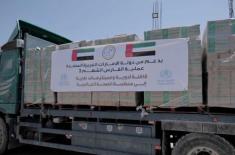
UAE delivers 65 tonness of medical supplies to Gaza in cooperation with WHO
2 hours ago

Sharjah to host 14th IGCF on 10–11 September 2025
2 hours ago

UAE President issues federal decree-law establishing National Anti-Narcotics Aut ..
2 hours ago

MoHAP launches new roadmap for more impactful services
3 hours ago

Museum of Future in Dubai welcomes 4 million visitors
4 hours ago
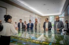
Abdulla Al Hamed visits Huawei’s R&D Centre in Shanghai
4 hours ago

Dubai Land Department: 24 real estate projects worth AED4.5 billion completed in ..
4 hours ago

China-Mongolia border port handles milestone 20,000 China-Europe freight trains
5 hours ago